Person
Lohajung is a picturesque village situated in the Chamoli district of Uttarakhand, at an elevation of around 2,300 meters (7,545 feet). It serves as the base for several popular treks, including the Roopkund Trek and Bagji Bugyal Trek. Surrounded by lush forests, snow-capped peaks, and alpine meadows, Lohajung offers a peaceful escape into nature. The village has rich cultural significance and is home to local communities living in harmony with nature. It is accessible by road from Rishikesh and acts as a gateway for trekkers heading towards some of Uttarakhand’s most stunning Himalayan destinations.
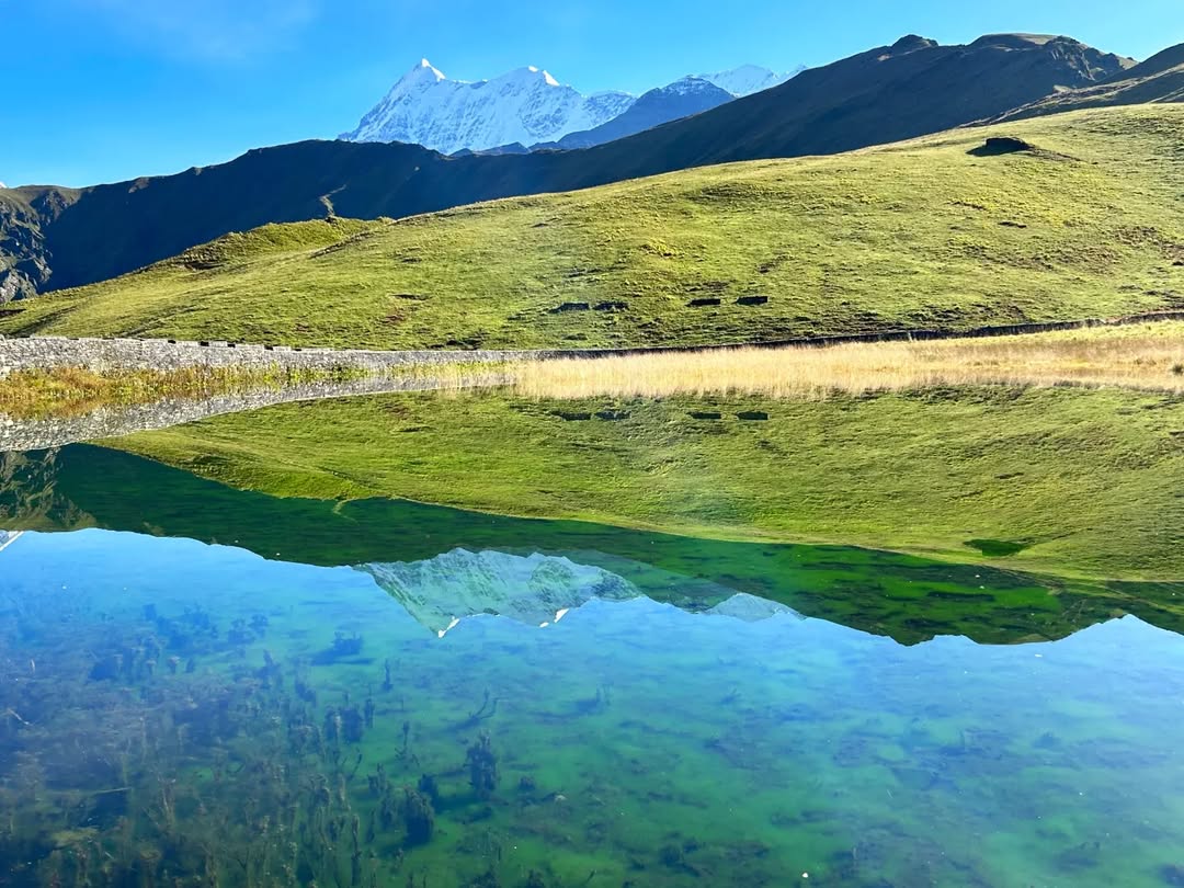
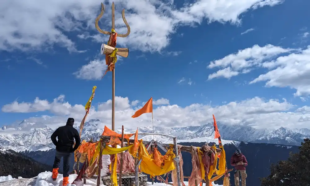
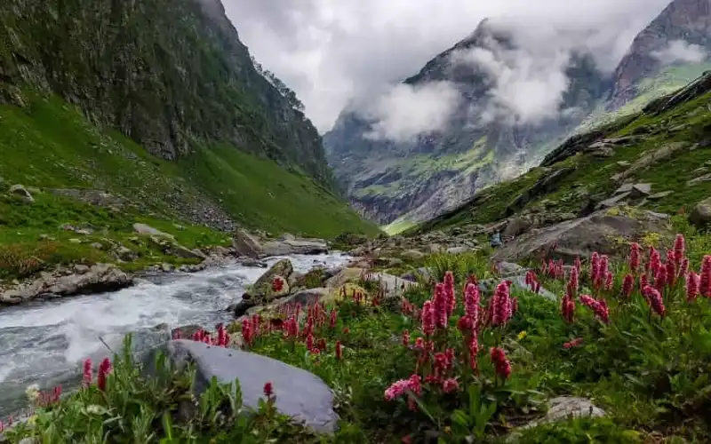
Bedni Bugyal is a beautiful high-altitude meadow located in Uttarakhand, at an elevation of around 3,354 meters (11,003 feet). It is a part of the famous Roopkund Trek and offers stunning views of the Nanda Devi, Trishul, and Bauna Parvat peaks. The meadow is known for its vast stretches of lush green grass during the summer and vibrant wildflowers, especially rhododendrons. The trek to Bedni Bugyal takes you through dense forests and alpine meadows, making it a favorite destination for trekkers. The site also holds cultural significance, with a sacred Bedni Kund lake nearby.
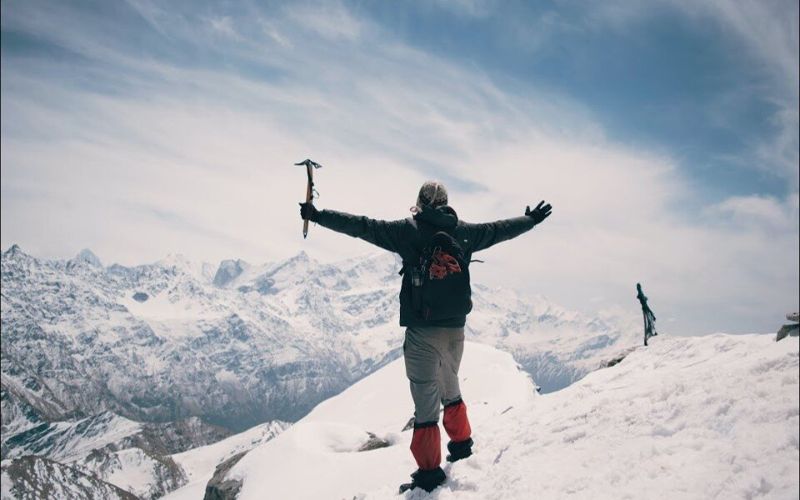
Roopkund Lake, located at an altitude of 5,029 meters (16,499 feet) in Uttarakhand, is a famous high-altitude glacial lake known for its mysterious and eerie reputation. Surrounded by snow-capped peaks like Trishul and Nanda Ghunti, it attracts trekkers from around the world. The lake is infamous for the skeletal remains found nearby, believed to be of ancient pilgrims or people who perished in a storm. The Roopkund Trek offers breathtaking views of lush forests, alpine meadows, and rugged terrains, making it a popular destination for adventure enthusiasts seeking a challenging and intriguing experience.
Jyunargali Pass is a high-altitude mountain pass located in the Garhwal Himalayas of Uttarakhand, standing at an elevation of around 5,500 meters (18,045 feet). It connects the Pindari Glacier region to the Nandakini Valley and offers trekkers panoramic views of snow-capped peaks, including Nanda Devi, Trishul, and Mrigthoni. Known for its rugged terrain, the pass presents a challenging trek that takes you through alpine meadows, dense forests, and glacial moraines. The Jyunargali Pass trek is ideal for experienced trekkers seeking adventure and the chance to explore remote and pristine Himalayan landscapes.
Homekund is a sacred high-altitude lake located in the Garhwal Himalayas of Uttarakhand, situated at an elevation of 4,800 meters (15,748 feet). Known for its serene beauty, the lake is surrounded by towering peaks, including Nanda Devi and Trishul. It is an important pilgrimage site for locals, with a rich cultural significance. The trek to Homekund offers trekkers breathtaking views of glaciers, alpine meadows, and pristine landscapes. The journey is challenging, passing through remote valleys, dense forests, and rugged terrains. Homekund remains a hidden gem, attracting adventure enthusiasts and spiritual seekers alike.
Ronti Saddle is a high-altitude pass in the Garhwal Himalayas of Uttarakhand, located at an elevation of around 5,200 meters (17,060 feet). It connects the Nandakini Valley to the Pindari Glacier region, offering spectacular views of surrounding snow-capped peaks, including Nanda Devi and Trishul. The trek to Ronti Saddle passes through lush meadows, dense forests, and rugged terrain, making it a challenging yet rewarding adventure. Known for its seclusion and untouched beauty, Ronti Saddle attracts experienced trekkers looking to explore remote areas and experience pristine Himalayan landscapes. The pass provides a true sense of wilderness and serenity.
Nanda Ghunti Basecamp is a stunning trekking destination located in Uttarakhand, at an altitude of around 3,600 meters (11,811 feet). The basecamp serves as the starting point for trekkers aiming to summit Nanda Ghunti Peak, offering mesmerizing views of the peak and surrounding snow-clad mountains. Surrounded by lush meadows, dense forests, and crystal-clear streams, the campsite provides a peaceful retreat amidst nature. Trekkers often use it as a stopover for acclimatization and to enjoy breathtaking vistas of Trishul, Mrigthoni, and Nanda Devi. The Nanda Ghunti Basecamp trek is ideal for those seeking adventure in the pristine Himalayas.
Trishul Basecamp is a popular trekking destination located in the Garhwal Himalayas of Uttarakhand, at an altitude of approximately 3,500 meters (11,482 feet). It offers stunning views of the iconic Trishul Peak (7,120 meters), known for its distinct trident shape. The trek to the basecamp takes you through lush forests, beautiful meadows, and rocky terrains, providing a mix of alpine beauty and rugged adventure. From the basecamp, trekkers can enjoy panoramic views of surrounding peaks, including Nanda Ghunti and Mrigthoni. The Trishul Basecamp trek is ideal for those seeking a challenging yet rewarding Himalayan adventure.
9 Days
8-10

The Ronti Saddle Trek is a beautiful and offbeat trek in Uttarakhand that promises an incredible adventure for those seeking to explore the Garhwal Himalayas. Here are the key highlights of the trek:
The Ronti Saddle Trek is an unforgettable journey through the heart of the Garhwal Himalayas. With its challenging trails, spectacular views, serene meadows, and diverse landscapes, it’s perfect for trekkers looking for an offbeat adventure away from the usual crowded routes. The trek offers a rewarding experience with a combination of natural beauty, solitude, and high-altitude exploration.
Overview:
On Day 1, you'll begin your journey from Rishikesh to Lohajung, the base of your trek. The drive is scenic, passing through picturesque towns and rivers, offering the opportunity to immerse yourself in the stunning landscapes of the Garhwal Himalayas.
You will reach Lohajung, a small village nestled at the foot of the Himalayas, famous for its scenic views and the base for many treks, including the Ronti Saddle and Roopkund Trek.
Once you arrive in Lohajung:
By the end of the day, you’ll have arrived at Lohajung, ready for the exciting trek ahead!
Initial Stretch (30 minutes to 1 hour):
Forest Trail (1.5 - 2 hours):
Midway Rest Stop (1 hour):
Final Stretch (1-1.5 hours):
Altitude: Around 2,500 meters (8,200 feet).
Accommodation: Set up camp or check into a guesthouse in the village (depending on your trek arrangements).
Take some time to explore the village and enjoy the simple life of the locals.
After reaching Didina, take a short walk around the village to acclimatize to the altitude.
You can visit the nearby fields, interact with the villagers, or enjoy the natural beauty of the surroundings.
6:00 PM: After a tiring day of trekking, gather for a group briefing about the next day’s trek.
Dinner: Enjoy a hearty dinner at the campsite, consisting of dal, roti, rice, and other local dishes.
The night sky in Didina is often incredibly clear, providing a perfect opportunity to stargaze and relax by the warmth of a bonfire (if permitted).
Rest: Ensure you get plenty of rest to recover for the next day’s trek to Ali Bedni Bugyal.
Initial Stretch (1 hour):
Gradual Ascent (1.5 - 2 hours):
Arrival at Ali Bugyal Meadows (2 - 3 hours):
Reaching Ali Bugyal:
After reaching the meadows, you’ll be greeted with a breathtaking panorama of the Himalayan ranges.
The camp will be set up in the meadow, offering a unique experience of camping in an expansive open field with a 360-degree view of the mountains.
Depending on weather and time, you can spend some time exploring the meadows or resting at the campsite.
The area is perfect for photography, so don't forget your camera to capture the natural beauty of the high-altitude meadow.
Ali Bugyal to Bedni Bugyal (1-2 hours)
Bedni Bugyal to Patarnachauni (2-3 hours)
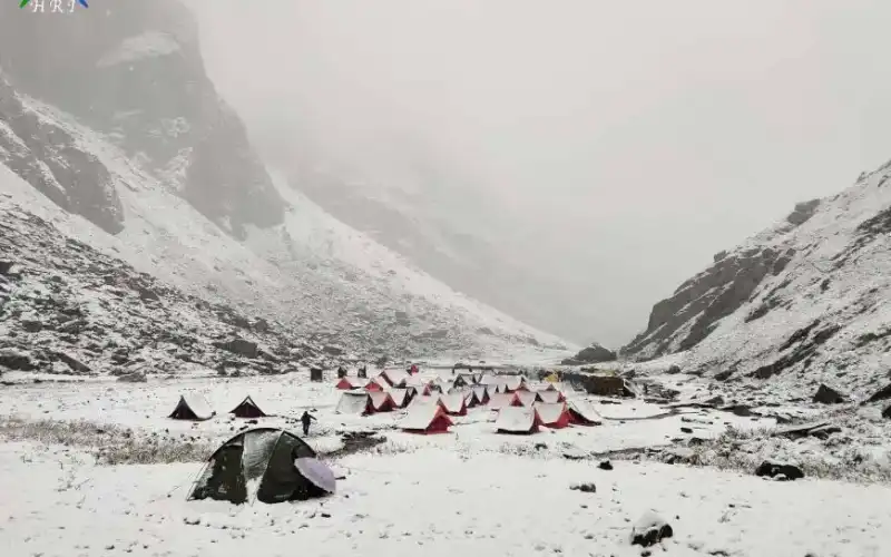
Patarnachauni to Baguwabasa (2-3 hours)
Normally Go Adven India expect to carry your personal luggage on your own, if you wish to offload your backpack, you can give it to Mule.
Charges of offloading backpack(if you are not able to carry your own backpack):-
INR 6000/- Bag/ whole trek
The backpack cannot weight more than 8 kgs. Backpack should have waterproof cover. Suitcases/strolleys/ bags will not be allowed. only trekking bags allowed)
GST - 5% (Mandatory) on Trek Fees
Off load Backpack - Rs 6000/ bag/ whole trek (if not able to carry)
Pick-Up Information: 6 AM
Arrival Time in Rishikesh: Ensure you arrive by 5:30 AM.
Pick-Up Location:
Tapovan, Rishikesh
Landmark: State bank of india, opposite Balak nath Mandir Tapovan, Rishikesh
Flight Options:
Fly Directly to Dehradun
Recommended for an added rest day in Rishikesh.
Frequent connections from major metro cities.
1-hour bus ride from Dehradun to Rishikesh or can hire a cab directly from airpot to your stay in tapovan, Rishikesh.
Fly to Delhi:
Arrive before 9:00 PM
Take a bus to Rishikesh from Delhi.
Train Options:
Departs New Delhi Railway Station at 6:45 AM, arrives in Haridwar at 11:30 AM.
Frequent buses from Haridwar to Rishikesh (1-hour journey).
Leaves Hazrat Nizamuddin at 3:20 PM, arrives in Haridwar at 7:33 PM.
Stay overnight in Tapovan, Rishikesh.
Overnight Bus Option:
Depart from Delhi’s ISBT Kashmiri Gate.
Frequent departures, taking about 8-9 hours.
Aim for a bus that arrives before 5:30 AM.
Additional Notes:
Last metro from the airport to New Delhi is at 11:15 PM.
Tapovan, Rishikesh
Arrival Time: Aim to reach Rishikesh between 6:30 PM and 7:30 PM.
Subsequent Travel Arrangements:
Plan any further travel after 10:00 PM to ensure you have enough time for your arrival and any necessary transitions or stay Rishikesh overnight.
When planning your return, keep the following in mind:
GoAdven India (GAI) is celebrated as one of the best trekking companies in India, renowned for its expertly curated treks and unwavering commitment to safety. The thrill of trekking in the Himalayas comes with inherent risks, making it essential for both beginners and experienced trekkers to prioritize safety. Here’s an overview of the comprehensive safety measures GAI implements before and during treks, ensuring every trekker can embark on their adventure with confidence.
a. Pre-Trek Briefings
At GAI, we believe that a well-informed trekker is a safer trekker, making pre-trek briefings a cornerstone of our safety strategy.
b. Medical Safety
The health and well-being of trekkers is a top priority at GAI.
c. Technical Safety
GAI prioritizes technical safety for navigating the challenging terrains of the Himalayas.
GAI understands the need for comprehensive emergency protocols in remote environments.
a. Emergency Response Plan
b. Evacuation Procedures
Efficient evacuation procedures are critical for the safety of trekkers.
At GoAdven India, we uphold the highest safety standards in the trekking industry. Our commitment extends beyond local regulations, striving to exceed them to ensure each trek is not only adventurous but also safe and enjoyable. With our meticulous preparations and robust safety protocols, trekkers can embark on their journeys with confidence and peace of mind.
(GoAdven India)
I understand that trekking is an outdoor adventure activity and involves inherent risks that cannot be completely eliminated. These risks include, but are not limited to, the following:
Unpredictable Weather: Sudden rain, cloudbursts, flash floods, Glacial Lake Outburst Floods (GLOFs), hailstorms, thunderstorms, lightning, strong winds, and rapid drops in temperature may occur during the trek or at campsites. Such conditions may require changes to the itinerary or cancellation of the trek without prior notice.
Wildlife & Insects: Encounters with wild animals, reptiles, insects, and arthropods are possible and may pose a safety risk.
Vegetation Hazards: Certain plants may be toxic, poisonous, or harmful. Any contact, consumption, or misuse may result in injury or illness.
Natural Disasters: Landslides, avalanches, earthquakes, whiteouts, or other natural events may occur in mountainous terrain and can be life-threatening.
Altitude-Related Illnesses: Risks include Acute Mountain Sickness (AMS), High Altitude Pulmonary Edema (HAPE), and High Altitude Cerebral Edema (HACE).
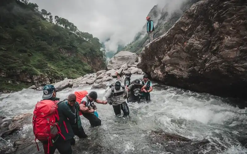
Physical Injuries: Uneven trails, loose rocks, slippery surfaces, or water crossings may lead to slips, falls, fractures, drowning, or other injuries.
Equipment-Related Accidents: Improper use, damage, or failure of trekking or safety equipment may cause injury.
Serious Accidents: Incidents may result in emotional distress, disfigurement, temporary or permanent disability, or paralysis.
Third-Party Actions: Injuries may occur due to the actions or negligence of other trekkers or individuals in the region.
Environmental Exposure: Prolonged exposure to sun, cold, wind, or altitude may cause dehydration, sunburn, hypothermia, frostbite, chilblains, hypoxia, heat-related or cold-related illnesses.
Limited Medical Support: Remote trekking regions may have minimal or no access to medical facilities or trained professionals.
Evacuation Difficulties: Rescue or evacuation during emergencies can be delayed, complex, or weather-dependent.
Social or Political Situations: Civil unrest, strikes, protests, or regional instability may disrupt travel or pose safety concerns.
Security Threats: Risks related to terrorism or other security issues cannot be ruled out.
Logistical Issues: Transportation delays, road closures, vehicle breakdowns, or cancellations may affect the trek.
Equipment Failure: Personal or group gear may malfunction or fail despite precautions.
Health Risks: Exposure to local diseases, infections, or illnesses is possible.
Unforeseen Circumstances: Any unexpected event beyond human control may impact safety or itinerary.
By choosing to participate in this trek, I confirm that:
I have carefully read and understood the risks involved.
I am voluntarily participating in the trekking activity.
I agree to follow all safety instructions, guidelines, and decisions made by the trek leaders.
I take full responsibility for the care and use of my personal and provided equipment.
I understand that GoAdven India’s staff and team members are trained and experienced, but trekking involves unpredictable conditions, and absolute safety cannot be guaranteed.
I accept that no individual or organization can foresee or prevent every possible risk.
I take full responsibility for my own health, safety, and well-being during the trek.
I acknowledge that I am solely responsible for ensuring that I am physically and mentally prepared for this trek. I confirm that I have reviewed and met the fitness and eligibility requirements prescribed for participation and have taken appropriate steps to prepare myself.
I confirm and declare that:
I am in sound physical and mental health at the time of joining the trek.
I do not suffer from any illness, injury, or medical condition that may affect my ability to safely participate.
I have not been medically advised to avoid strenuous physical activity or high-altitude travel.
I agree to disclose any relevant medical information to the organizers if required for safety reasons.
I further acknowledge and agree that:
I am personally responsible for my safety, health, and well-being throughout the trek.
I willingly accept and assume all risks associated with trekking, whether foreseeable or unforeseen.
I understand and agree that GoAdven India shall not be held responsible or liable for any injury, accident, illness, loss, or damage that may occur during or after the trek.
I accept full responsibility for any medical treatment, evacuation, or related expenses incurred during or following the trek.
I hereby acknowledge and agree that:
I shall be fully responsible for my actions and conduct during the trek.
In the event that my actions, whether intentional or unintentional, cause injury to any person or result in loss or damage to property or life, I accept complete responsibility for the consequences.
I agree to indemnify, defend, and hold harmless GoAdven India, its team members, staff, guides, and associates from any claims, liabilities, losses, or expenses arising due to my actions.
I undertake to bear all costs related to repairs, compensation, medical treatment, or any other expenses incurred as a result of such incidents caused by me.
I acknowledge that this trek involves high-altitude conditions, and I may experience symptoms related to altitude sickness or reduced oxygen levels. I understand that for my safety, the trek leader has full authority to assess my condition at any stage and may require me to descend to a lower altitude if continuing is considered unsafe.
I understand and agree that:
Routine health monitoring will be conducted at camps, including checks of oxygen saturation (SpO₂), pulse rate, and blood pressure.
If my vital readings fall outside the safe range for a particular altitude, the trek leader may restrict my ascent or remove me from the trek, without any entitlement to a refund.
The accepted safety parameters for each altitude are defined by GoAdven India and are available with the trek leadership team.
I am aware that this is a physically demanding high-altitude trek involving uneven, rocky, snowy, and challenging terrain. I accept that:
The trek leader has the final authority to turn back or discontinue my participation if, in their judgment, I am unable to complete the itinerary safely or require exclusive assistance.
I confirm that I have honestly and realistically evaluated my fitness level, endurance, and suitability for this trek before registering.
I fully understand that the consumption of alcohol, smoking, or use of recreational or narcotic substances is strictly prohibited during the trek.
I accept that:
If I am found consuming or carrying any such substances, I will be immediately removed from the trek.
I will be required to descend and exit the trek/basecamp at my own responsibility, without any claim for refund or compensation.
If I am 58 years of age or older, I acknowledge and agree to the following safety protocol:
a. High-altitude trekking places significant stress on the cardiovascular system. With increasing age, this stress may increase the risk of serious or life-threatening complications, particularly for individuals with a history of high blood pressure or heart-related conditions.
b. A Treadmill Test (TMT) provides a clear medical assessment of cardiovascular fitness and helps determine readiness for high-altitude trekking. This test, along with proper fitness preparation, significantly improves trek safety.
c. GoAdven India encourages trekking for all age groups while prioritizing safety. This protocol has been introduced solely to reduce health risks and ensure a safe and successful trekking experience.
d. I agree to submit a valid Treadmill Test report within 7 days of trek registration.
If the report confirms healthy cardiovascular function, I may continue with the trek and focus on fitness preparation.
e. If the report indicates medical concerns, GoAdven India may advise me to postpone participation and improve my health before reapplying. In such cases, the trek fee will be refunded as per applicable policies.
I confirm that I have thoroughly read, understood, and accepted all terms, conditions, and legal implications of this agreement. I voluntarily agree to be bound by all provisions contained herein.
I further acknowledge that if any clause or part of this agreement is held to be invalid, unlawful, or unenforceable, such determination shall not affect the validity or enforceability of the remaining provisions, which shall continue to remain effective.
I understand and agree that GoAdven India has determined the pricing, structure, and offering of this trek based on my acceptance of these terms. I acknowledge that without my consent to this agreement, GoAdven India would not be able to provide or conduct the trekking services.
I also agree that my acceptance of this agreement through electronic means, including digital signatures or online confirmation, shall be considered legally valid and equivalent to signing a physical, original document.
I acknowledge that it is solely my responsibility to arrange, carry, and maintain all documents required for my travel and participation in the trek, including but not limited to valid identification, passports, visas, permits, or any other mandatory paperwork.
I understand that I may be required to present these documents to government authorities, local officials, or trek staff during travel or while on the trek. I agree that GoAdven India shall not be held responsible for any consequences arising from my inability to produce the required documents when asked.
I further accept that GoAdven India is not liable for any loss, theft, misplacement, or damage to my personal travel or identity documents at any stage of the trip.
I voluntarily submit a copy of my valid Personal Identification (such as my latest Aadhaar Card or Passport) to GoAdven India strictly for limited purposes, including identity verification, permit processing, regulatory compliance, and administrative requirements directly related to my participation in the trek.
I understand and agree that:
My personal information will be used only for the purposes stated above.
GoAdven India will handle and process my data in accordance with applicable laws, regulations, and data protection standards.
Reasonable measures will be taken to maintain confidentiality and prevent unauthorized access or misuse of my personal data.
I retain the right to withdraw my consent by providing written notice, provided such withdrawal occurs before the information is utilized for the stated purposes.
(GoAdven India)
I clearly understand and agree that smoking, consumption of alcohol, or use of any intoxicating or recreational substance is strictly prohibited throughout the trek. This restriction applies at all locations, including but not limited to the basecamp, campsites, trails, accommodation areas, and any premises associated with GoAdven India.
I acknowledge that GoAdven India reserves the full right to immediately discontinue my participation in the trek if I am found violating this policy at any point.
I further understand and accept that GoAdven India has the authority to require me to withdraw from the trek under the following circumstances:
If I suffer from any injury, illness, or medical condition that makes it unsafe or impractical for me to continue.
If my physical fitness level significantly impacts the pace, schedule, or safety of the rest of the group.
If my health indicators, including blood pressure or oxygen saturation (SpO₂) levels, fall outside the safe and acceptable range for the altitude and terrain.
I agree that GoAdven India may immediately terminate my participation and remove me from the trek or basecamp if I engage in any conduct deemed inappropriate, unsafe, or disruptive. This includes, but is not limited to:
i. Sexual misconduct or harassment towards fellow trekkers, staff members, guides, or any other individual.
ii. Non-compliance with trek rules, safety protocols, or instructions issued by the trek leaders, which are applicable equally to all participants.
iii. Aggressive, abusive, or threatening behaviour, whether verbal or physical, including but not limited to:
Use of abusive language or profanity during disagreements
Issuing threats toward trekkers or GoAdven India staff
Shouting, screaming, or intimidating behaviour
Physical contact such as pushing or shoving
Making offensive religious, political, sexist, or discriminatory remarks
iv. Intentional misuse, mishandling, or damage of trekking, camping, or safety equipment provided by GoAdven India.
I fully understand and agree that if my participation in the trek is ended due to any of the reasons stated above:
I shall not be entitled to a trek completion certificate.
I shall not be eligible for any refund, partial or otherwise, of the trek fees paid.
I shall bear all costs associated with my return to the basecamp or exit point, including expenses for transport, mule, porter, guide, or any other logistical arrangements required.
Where is Ronti Saddle located? Ronti Saddle is situated in the Chamoli district of Uttarakhand, nestled between the peaks of Nanda Ghunti and Trishul.
The trek spans approximately 104 kilometers and typically takes about 8 days to complete. It is considered a tough-grade trek, suitable for experienced adventurers.
The highest point is the Ronti Saddle, located at an altitude of 5,300 meters (17,360 feet) above sea level.
Yes, the trail passes by Roopkund Lake, known for the skeletal remains found there, adding a unique aspect to the journey.
Absolutely, the trek route includes the beautiful meadows of Ali and Bedni Bugyal, offering scenic landscapes and lush greenery.
Yes, prior experience of at least two week-long treks at altitudes between 3,500 to 4,500 meters is recommended due to the trek's challenging nature.
The trek is rated as difficult, requiring good physical fitness and acclimatization to high altitudes.
Preparation involves regular cardio exercises, strength training, and practicing at higher altitudes if possible. Consulting with experienced trekkers or guides can also provide valuable insights.
(GoAdven India)
I understand that trekking is an outdoor adventure activity and involves inherent risks that cannot be completely eliminated. These risks include, but are not limited to, the following:
Unpredictable Weather: Sudden rain, cloudbursts, flash floods, Glacial Lake Outburst Floods (GLOFs), hailstorms, thunderstorms, lightning, strong winds, and rapid drops in temperature may occur during the trek or at campsites. Such conditions may require changes to the itinerary or cancellation of the trek without prior notice.
Wildlife & Insects: Encounters with wild animals, reptiles, insects, and arthropods are possible and may pose a safety risk.
Vegetation Hazards: Certain plants may be toxic, poisonous, or harmful. Any contact, consumption, or misuse may result in injury or illness.
Natural Disasters: Landslides, avalanches, earthquakes, whiteouts, or other natural events may occur in mountainous terrain and can be life-threatening.
Altitude-Related Illnesses: Risks include Acute Mountain Sickness (AMS), High Altitude Pulmonary Edema (HAPE), and High Altitude Cerebral Edema (HACE).
Physical Injuries: Uneven trails, loose rocks, slippery surfaces, or water crossings may lead to slips, falls, fractures, drowning, or other injuries.
Equipment-Related Accidents: Improper use, damage, or failure of trekking or safety equipment may cause injury.
Serious Accidents: Incidents may result in emotional distress, disfigurement, temporary or permanent disability, or paralysis.
Third-Party Actions: Injuries may occur due to the actions or negligence of other trekkers or individuals in the region.
Environmental Exposure: Prolonged exposure to sun, cold, wind, or altitude may cause dehydration, sunburn, hypothermia, frostbite, chilblains, hypoxia, heat-related or cold-related illnesses.
Limited Medical Support: Remote trekking regions may have minimal or no access to medical facilities or trained professionals.
Evacuation Difficulties: Rescue or evacuation during emergencies can be delayed, complex, or weather-dependent.
Social or Political Situations: Civil unrest, strikes, protests, or regional instability may disrupt travel or pose safety concerns.
Security Threats: Risks related to terrorism or other security issues cannot be ruled out.
Logistical Issues: Transportation delays, road closures, vehicle breakdowns, or cancellations may affect the trek.
Equipment Failure: Personal or group gear may malfunction or fail despite precautions.
Health Risks: Exposure to local diseases, infections, or illnesses is possible.
Unforeseen Circumstances: Any unexpected event beyond human control may impact safety or itinerary.
By choosing to participate in this trek, I confirm that:
I have carefully read and understood the risks involved.
I am voluntarily participating in the trekking activity.
I agree to follow all safety instructions, guidelines, and decisions made by the trek leaders.
I take full responsibility for the care and use of my personal and provided equipment.
I understand that GoAdven India’s staff and team members are trained and experienced, but trekking involves unpredictable conditions, and absolute safety cannot be guaranteed.
I accept that no individual or organization can foresee or prevent every possible risk.
I take full responsibility for my own health, safety, and well-being during the trek.
I acknowledge that I am solely responsible for ensuring that I am physically and mentally prepared for this trek. I confirm that I have reviewed and met the fitness and eligibility requirements prescribed for participation and have taken appropriate steps to prepare myself.
I confirm and declare that:
I am in sound physical and mental health at the time of joining the trek.
I do not suffer from any illness, injury, or medical condition that may affect my ability to safely participate.
I have not been medically advised to avoid strenuous physical activity or high-altitude travel.
I agree to disclose any relevant medical information to the organizers if required for safety reasons.
I further acknowledge and agree that:
I am personally responsible for my safety, health, and well-being throughout the trek.
I willingly accept and assume all risks associated with trekking, whether foreseeable or unforeseen.
I understand and agree that GoAdven India shall not be held responsible or liable for any injury, accident, illness, loss, or damage that may occur during or after the trek.
I accept full responsibility for any medical treatment, evacuation, or related expenses incurred during or following the trek.
I hereby acknowledge and agree that:
I shall be fully responsible for my actions and conduct during the trek.
In the event that my actions, whether intentional or unintentional, cause injury to any person or result in loss or damage to property or life, I accept complete responsibility for the consequences.
I agree to indemnify, defend, and hold harmless GoAdven India, its team members, staff, guides, and associates from any claims, liabilities, losses, or expenses arising due to my actions.
I undertake to bear all costs related to repairs, compensation, medical treatment, or any other expenses incurred as a result of such incidents caused by me.
I acknowledge that this trek involves high-altitude conditions, and I may experience symptoms related to altitude sickness or reduced oxygen levels. I understand that for my safety, the trek leader has full authority to assess my condition at any stage and may require me to descend to a lower altitude if continuing is considered unsafe.
I understand and agree that:
Routine health monitoring will be conducted at camps, including checks of oxygen saturation (SpO₂), pulse rate, and blood pressure.
If my vital readings fall outside the safe range for a particular altitude, the trek leader may restrict my ascent or remove me from the trek, without any entitlement to a refund.
The accepted safety parameters for each altitude are defined by GoAdven India and are available with the trek leadership team.
I am aware that this is a physically demanding high-altitude trek involving uneven, rocky, snowy, and challenging terrain. I accept that:
The trek leader has the final authority to turn back or discontinue my participation if, in their judgment, I am unable to complete the itinerary safely or require exclusive assistance.
I confirm that I have honestly and realistically evaluated my fitness level, endurance, and suitability for this trek before registering.
I fully understand that the consumption of alcohol, smoking, or use of recreational or narcotic substances is strictly prohibited during the trek.
I accept that:
If I am found consuming or carrying any such substances, I will be immediately removed from the trek.
I will be required to descend and exit the trek/basecamp at my own responsibility, without any claim for refund or compensation.
If I am 58 years of age or older, I acknowledge and agree to the following safety protocol:
a. High-altitude trekking places significant stress on the cardiovascular system. With increasing age, this stress may increase the risk of serious or life-threatening complications, particularly for individuals with a history of high blood pressure or heart-related conditions.
b. A Treadmill Test (TMT) provides a clear medical assessment of cardiovascular fitness and helps determine readiness for high-altitude trekking. This test, along with proper fitness preparation, significantly improves trek safety.
c. GoAdven India encourages trekking for all age groups while prioritizing safety. This protocol has been introduced solely to reduce health risks and ensure a safe and successful trekking experience.
d. I agree to submit a valid Treadmill Test report within 7 days of trek registration.
If the report confirms healthy cardiovascular function, I may continue with the trek and focus on fitness preparation.
e. If the report indicates medical concerns, GoAdven India may advise me to postpone participation and improve my health before reapplying. In such cases, the trek fee will be refunded as per applicable policies.
I confirm that I have thoroughly read, understood, and accepted all terms, conditions, and legal implications of this agreement. I voluntarily agree to be bound by all provisions contained herein.
I further acknowledge that if any clause or part of this agreement is held to be invalid, unlawful, or unenforceable, such determination shall not affect the validity or enforceability of the remaining provisions, which shall continue to remain effective.
I understand and agree that GoAdven India has determined the pricing, structure, and offering of this trek based on my acceptance of these terms. I acknowledge that without my consent to this agreement, GoAdven India would not be able to provide or conduct the trekking services.
I also agree that my acceptance of this agreement through electronic means, including digital signatures or online confirmation, shall be considered legally valid and equivalent to signing a physical, original document.
I acknowledge that it is solely my responsibility to arrange, carry, and maintain all documents required for my travel and participation in the trek, including but not limited to valid identification, passports, visas, permits, or any other mandatory paperwork.
I understand that I may be required to present these documents to government authorities, local officials, or trek staff during travel or while on the trek. I agree that GoAdven India shall not be held responsible for any consequences arising from my inability to produce the required documents when asked.
I further accept that GoAdven India is not liable for any loss, theft, misplacement, or damage to my personal travel or identity documents at any stage of the trip.
I voluntarily submit a copy of my valid Personal Identification (such as my latest Aadhaar Card or Passport) to GoAdven India strictly for limited purposes, including identity verification, permit processing, regulatory compliance, and administrative requirements directly related to my participation in the trek.
I understand and agree that:
My personal information will be used only for the purposes stated above.
GoAdven India will handle and process my data in accordance with applicable laws, regulations, and data protection standards.
Reasonable measures will be taken to maintain confidentiality and prevent unauthorized access or misuse of my personal data.
I retain the right to withdraw my consent by providing written notice, provided such withdrawal occurs before the information is utilized for the stated purposes.
(GoAdven India)
I clearly understand and agree that smoking, consumption of alcohol, or use of any intoxicating or recreational substance is strictly prohibited throughout the trek. This restriction applies at all locations, including but not limited to the basecamp, campsites, trails, accommodation areas, and any premises associated with GoAdven India.
I acknowledge that GoAdven India reserves the full right to immediately discontinue my participation in the trek if I am found violating this policy at any point.
I further understand and accept that GoAdven India has the authority to require me to withdraw from the trek under the following circumstances:
If I suffer from any injury, illness, or medical condition that makes it unsafe or impractical for me to continue.
If my physical fitness level significantly impacts the pace, schedule, or safety of the rest of the group.
If my health indicators, including blood pressure or oxygen saturation (SpO₂) levels, fall outside the safe and acceptable range for the altitude and terrain.
I agree that GoAdven India may immediately terminate my participation and remove me from the trek or basecamp if I engage in any conduct deemed inappropriate, unsafe, or disruptive. This includes, but is not limited to:
i. Sexual misconduct or harassment towards fellow trekkers, staff members, guides, or any other individual.
ii. Non-compliance with trek rules, safety protocols, or instructions issued by the trek leaders, which are applicable equally to all participants.
iii. Aggressive, abusive, or threatening behaviour, whether verbal or physical, including but not limited to:
Use of abusive language or profanity during disagreements
Issuing threats toward trekkers or GoAdven India staff
Shouting, screaming, or intimidating behaviour
Physical contact such as pushing or shoving
Making offensive religious, political, sexist, or discriminatory remarks
iv. Intentional misuse, mishandling, or damage of trekking, camping, or safety equipment provided by GoAdven India.
I fully understand and agree that if my participation in the trek is ended due to any of the reasons stated above:
I shall not be entitled to a trek completion certificate.
I shall not be eligible for any refund, partial or otherwise, of the trek fees paid.
I shall bear all costs associated with my return to the basecamp or exit point, including expenses for transport, mule, porter, guide, or any other logistical arrangements required.
From
₹29,500.00 ₹30,000.00
Looking for more info? Send a question to our Ronti Saddle Trek Expert to find out more.
Travel is my life. Since 1999, I have been traveling around the world nonstop. If you also love travel, you are in the right place!